Researchers forecast the future of wildlife habitat in Northern Alaska
In May last year, the small town of Eagle, in interior Alaska broke a record both unsettling and portentous. Temperatures had soared to 91 degrees Fahrenheit, the earliest 90-degree day ever recorded for the town. Later, state climate officials reported the month was the warmest May on record for Alaska. After the warm and very dry spring, the state suffered one of its worst wildfire seasons. Flames and smoke ploughed through 5 million acres of forests, grasslands, and tundra.
Scientists think the fires and the record high temperatures are just a few of many signs of Alaska’s transformation in a warming climate. And more changes are coming. Warming is happening more than twice as fast in the Arctic than anywhere else on Earth. With most of the state within arctic and sub-arctic environments, the Forest Service is concerned about further changes to the land and the wildlife and communities that depend on it.
Bruce G. Marcot, a research wildlife biologist with the USDA Forest Service, Pacific Northwest Research Station, is the lead scientist behind the WILDlife Potential Habitat ForeCASTing Framework (WildCast), a collaboration between the Forest Service, the National Park Service (NPS), and the U.S. Geological Survey (USGS). Marcot and his colleagues set out to understand how these changes might play out in the country’s largest and northernmost state. “We wanted to look ahead to the next century and forecast what could happen under climate change,” Marcot says. “How would habitats change? How would wildlife be affected?”
A shift from short to tall
Alaska is vast, raw, and unforgiving. It covers 663,000 square miles—easily bigger than most East Coast states put together—and boasts a diverse range of landscapes. There are glaciers, snow-capped mountains, and tundra fields. There are also long stretches of wilderness, a few volcanic islands, and some sand dune fields. “The National Park Service units and U.S. Fish and Wildlife refuges there are just astounding examples of vast, untouched areas,” Marcot says. “You could fly for hours and hours and see absolutely no sign of people—no camps, trails, roads, or anything. It’s just spectacular.”
Yet the state’s very breadth and isolation make it tough to explore and study. Tourists and backpackers are often caught unprepared for the large distances between towns, national parks, and other attractions, not to mention the high cost of transportation, food, and lodging. Lonely Planet, a travel guidebook, described some of the national parks here as so remote the International Space Station gets more annual visitors. It’s not a surprise that Marcot and his colleagues had to refer to satellite images to assess the types of land cover, or ecotypes, in their vast study area.
Their study area comprises five units of the National Park Service and one national wildlife refuge in northwest Alaska. Abutting the sea ice-encrusted Chukchi and Bering seas on the north and west are the wetlands and archeological sites of Cape Krusenstern National Monument and the hot springs and lava flows of the Bering Land Bridge National Preserve. Also on the west are the Noatak National Preserve and its mountain-ringed river basins; Kobuk Valley National Park and its shifting sand dunes; and the Selawik National Wildlife Refuge and its extensive wetlands. To the east lie the glacier-carved valleys of the Gates of the Arctic National Park and Preserve. All in all the study area covers 62,884 square miles. “That’s larger than the state of Georgia and bigger than 64 percent of all countries on Earth,” Marcot says.
Marcot worked with Torre Jorgenson, a researcher at Alaska Ecoscience who developed the satellite-derived ecotype map, to simulate changes that would happen to each of the 60 ecotypes in the study area. “We came up with a transition process in a spreadsheet-based model to ask what’s going to happen to each of the ecotypes up there—those ponds, forests, tundra fields—over the 21st century,” Marcot says.
Marcot and Jorgenson looked at historical trends in average annual air temperature from weather stations, then examined how fast or slow ecosystems responded to different factors, such as wildfire or high temperatures, during the last 30 to 50 years. They applied these trends and rates to a statistical model that projected detailed changes for each of the 60 ecotypes for the rest of the century.
The researchers found that the area occupied by dominant shrub types in the lowlands will decline by 65 percent and tall shrubs and trees will steadily increase. Permafrost, or frozen ground under the tundra, will likely continue to thaw because of higher temperatures. Forests, grasslands, and tundra will dry up, leading to an increase in wildfires. In turn, wildfires will allow new vegetation to spread to areas that had been burned, a process called vegetation succession. Thirty-three ecotypes would gain area, 23 would lose area, and four would stay the same.
“In general there is going to be a shift from grassland tundra and low shrub to taller shrub and woodland and spruce forests,” Marcot says. “A lot of the bogs, fens, wet grasslands, and tundra lakes will likely drain and dry out. Permafrost underneath these wetlands is going to start to thaw further through the ground, which is almost like punching a hole in the bottom of a bathtub. So there is going to be a fair loss of aquatic and wetland types too.”
The forecasted shift from short plants to tall trees and forests is telling. Most Arctic plants have adapted to the area’s extremely low temperatures by growing close together and near the ground. This protects them from the cold and the strong winds. With higher temperatures coming, vegetation in these regions won’t need to huddle and stay low. “That’s a big change, especially if you think of species like caribou which focus on, use, and migrate across a lot of the open grassland tundra.” That was the puzzle that the researchers attempted to solve next. With these big changes happening to the land and the vegetation, what would happen to wildlife that depend on these habitats?
Gainers and losers
The researchers now knew how ecotypes in the study area might change, but there was no readily available dataset on how wildlife species use these ecotypes. “So I worked with researchers in the NPS and USGS to build the first ever wildlife-habitat relationships information base for this area,” Marcot says.
To do this, the researchers listed all 162 species of birds and 39 species of mammals that lived within or near the study area, and plotted out how much each of the species used each ecotype, raking them low, moderate, or high. Marcot and his colleagues also determined each species’ total habitat area, how many ecotypes each species used, and the number of species each ecotype supported. Marcot says developing this database was one of the most challenging parts of the study, as the researchers relied on field studies, published literature, and consultations with numerous Forest Service, NPS, and USGS experts. “That took a fair amount of time and effort,” Marcot says.
“Then we tied the projected changes for each of the 60 ecotypes to how each of the species of mammals and birds used those ecotypes,” Marcot says. The researchers used statistical models to make projections under three scenarios: the first assumed ecotype changes will continue at the same rate (time model); the second related past rates of ecotype changes to recent trends of increasing regional air temperatures (temperature model); and the third adjusts the temperature model to biophysical factors, such as the expansion of tall shrubs and trees, changes in water balance, river erosion, and the impact of wildfires (rate-adjusted temperature model).

The time model forecasted that up to 52 percent of the 201 bird and mammal species currently occurring in the area will experience habitat expansion, 45 percent will see habitat contractions, and 3 percent will experience no habitat change. More species were projected to lose their habitats in the rate-adjusted model and more so in the temperature model.
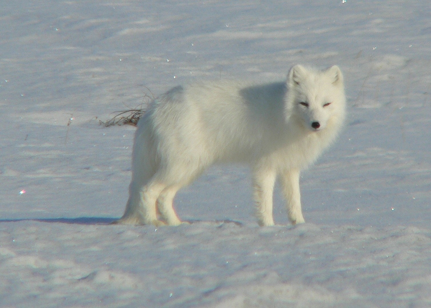
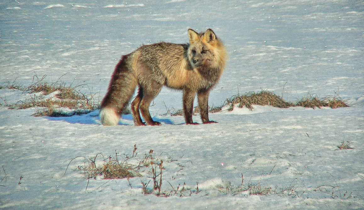
Overall, species whose habitats are projected to expand include those occupying forest and tall-shrub ecotypes, such as grouse and black bear, while species whose habitats are projected to decline include those occupying meadow and low-shrub ecotypes, like ptarmigan and caribou. Most of the small mammals that form the prey base for larger carnivores and raptors, such as lemmings, voles, and shrews, will also lose some habitat. “I am hypothesizing that a trophic cascade effect is going to happen,” Marcot says. “That’s when you lose these key prey for carnivores, and the food chain gets disrupted.”
Marcot and his colleagues also found that a greater proportion of mammal species would experience habitat declines than would bird species. In addition, half of the 50 bird and mammal species used for subsistence hunting, including greater white-fronted goose, tundra swan, caribou, mink, and muskrat will experience habitat decline.
“There is going to be a change in seasonality when people can physically get out on the tundra to fish and hunt,” Marcot says. “With summer happening earlier and ending later, a lot of the frozen ground that they can travel over by snowshoe or snowmobile becomes mush and marsh, and this will impede their ability to hunt for food.” And because habitats will be shifting as well, subsistence hunters may have to travel to different areas to find food. “These shifts of habitat may not necessarily be close to the villages out there,” Marcot says. “So there will be a change in access and how far people might have to travel to get to these new environments and certain subsistence species, and these changes won’t be evenly spread.”
Living in change, documenting change
The WildCast project’s findings will be valuable to land managers as they develop climate change adaptation policies for federal lands in the region. Regulations and policies will need to change as certain species and ecotypes become more or less rare, particularly with subsistence species for local communities. “Land managers for the Central Yukon and Seward Peninsula rapid ecosystem assessment teams are already using our findings in their planning discussions,” Marcot says. In addition, the NPS is using the findings in the agency’s brief State of the Parks assessment and the more detailed and in depth Natural Resources Conditions Assessment for Cape Krusenstern National Monument, Bering Land Bridge National Preserve, Noatak National Preserve, Kobuk Valley National Park, and Gates of the Arctic National Park and Preserve, according to Jim Lawler, program manager for the Arctic Network Inventory and Monitoring Program of the NPS. “My hope is that this gets more managers engaged in using tools like this in their planning,” Lawler says.
The project’s findings are also crucial information for 229 federally-recognized Indigenous tribes in Alaska already experiencing the impact of climate change in their daily lives. About thirty villages are already in the process of or considering relocation because of thawing permafrost, sea level rise, and increased flooding.
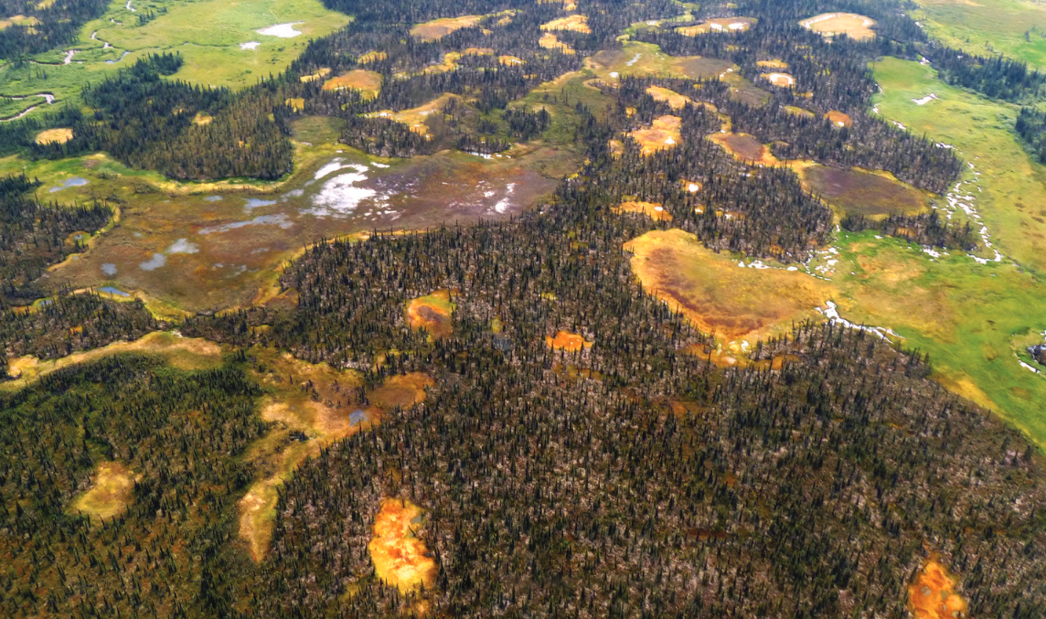
To enhance the two studies, Marcot and his colleagues also produced a photographic transect of the study area. Marcot strapped cameras to four-seater Cessna planes and over three days’ flights documented current conditions and evidence of changes, such as drained lakes, thawing hills, forest fires, and expansions of tall shrubs and spruce forest. “I took a couple hundred thousand photos, all geotagged and orthorectified, along the 1,600 miles of flight transects, along with high-definition videos,” Marcot said. “We built a high-resolution, low-altitude imagery dataset, a legacy of images that future studies could tie into that could run the same sites, and thereby compare the changes over time.” Marcot also innovated a new photogrammetric method of doing the photo time-lapse transects.
To Marcot, these are all a simple step to further understand Alaska’s transformation and anticipate changes that might happen in other circumpolar regions. “We hope this opens the door to lots of follow-up studies,” he says. “I view our work as producing testable working hypotheses that can be validated and refined over time through further studies and monitoring. It’s a first approximation and not a definitive prediction of changes in wildlife population sizes to come, so continued studies will help refine our predictions and likely provide some surprises as the region continues to change.”
Originally published in Science Findings. Download the publication here. This story was also reprinted in The Forestry Source.