Scientists and satellites hold vigil on a newborn lake in Pakistan.
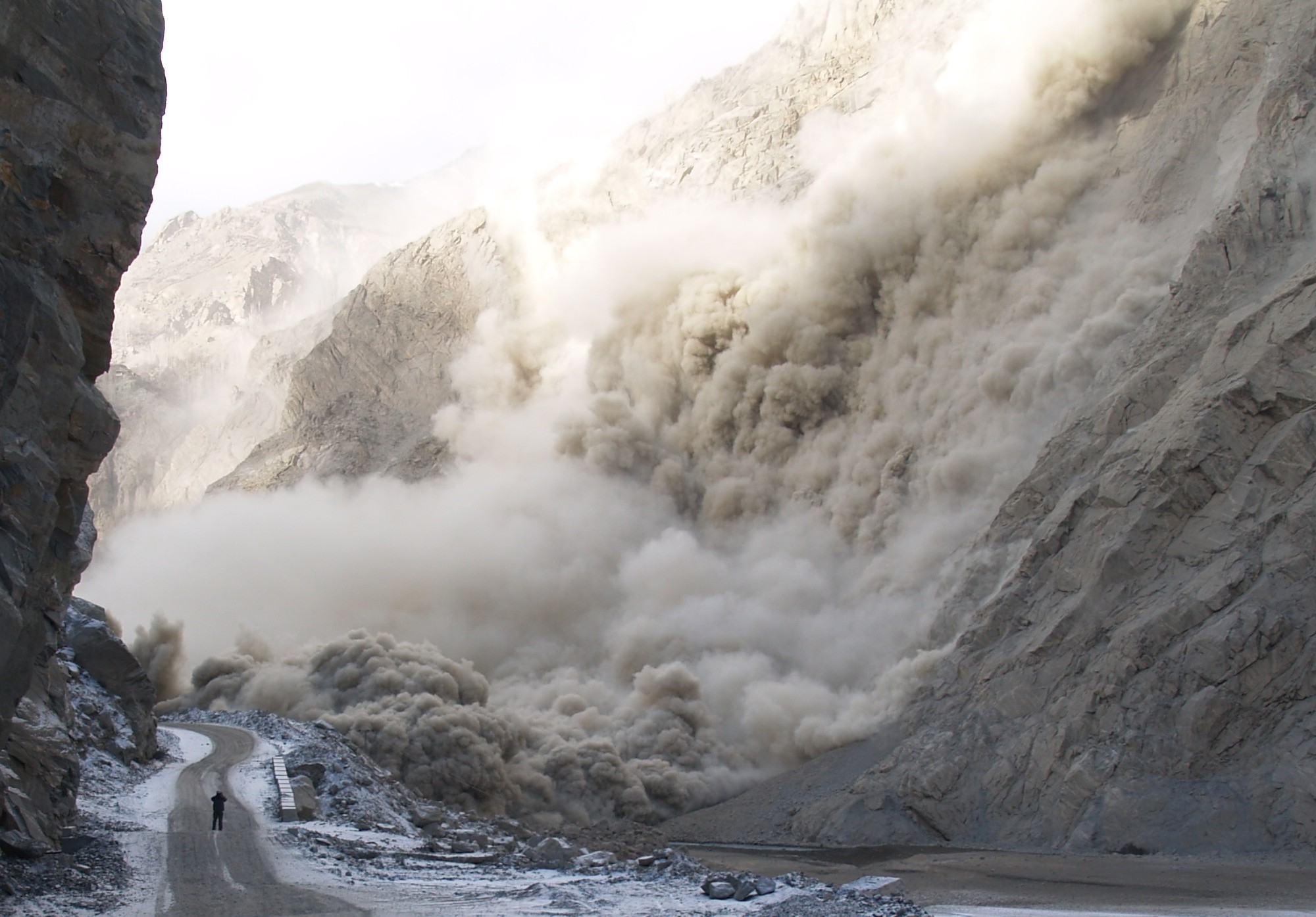
A NERVOUS sense of humor greets travelers at the highest and most scenic road in the world. Hand-painted signs saying, “Relax, slide area ends” dot sections of the Karakoram Highway along the Hunza River in northern Pakistan. Landslides are commonplace here. But on January 4, 2010, a massive rockslide buried part of a village and blocked the river’s flow. Boulders, rocks, and debris tumbled down the mountainside that day, killing twenty people and damming the river until it swelled and swallowed more communities. In months, the plugged-up river would submerge eleven miles of the Karakoram Highway, turning a thriving region buzzing with trade from the Chinese border into scattered clumps of unconnected villages.
When hydrologist Jeffrey Kargel of the University of Arizona saw news footage of the rockslide, he had a hunch the flooded river could swell into a lake. He asked geologist Gregory Leonard to check recent satellite images of the area. “Sure enough, there was a lake forming behind the rockslide dam,” said Leonard, Kargel’s colleague at the University of Arizona. “It’s always startling to see the first images of these kinds of things.” Something else worried Kargel. Three huge glaciers, including the thirty-five-mile long Batura Glacier, are perched on the mountains above the flooded villages. In spring, those glaciers would start gushing melt water down into the new lake. Kargel said, “If the rockslide dam overflowed and burst, more people downstream would be in harm’s way.” Kargel studies glaciers and the hazards for communities living near them. He had the tools to figure out when the new Lake Gojal would overflow. But he and Leonard had to do it fast, if the information was to be of any help.
Originally published in Sensing Our Planet: NASA Earth Science Research Features. Read the full story here.
Image courtesy I. Ali [Shimshal]/Pamir Times.